Posted June 18, 2024
National Culvert Removal, Replacement & Rehabilitation Grants
$196M+ in FY2023 Grants available
Applications Due on September 23, 2024
Aquatic Organism Passage (AOP) is a modern approach to the nexus of our highways and the aquatic environment along stream corridors. AOP water crossing structures provide for safe and resilient roadway corridors for the traveling public while also providing the needed nature-like riverine conditions for the passage of native fish and other aquatic life species. Today, we are emphasizing the use of AOP structures from coast to coast as a key tool in the restoration of habitat for threatened native fish populations.
Our current practices in AOP design are continually evolving as new lessons are learned throughout the U.S. during the construction and long-term performance of AOP water crossing structures. The Aquatic Organism Passage Monitoring & Assessment Protocol (aopMAP) was born out of the need to document and openly share practices in AOP design that are working for the benefit of future designs. We developed aopMAP as a robust monitoring tool to collect and catalogue data from all types of AOP structures, in all geographic settings, and from any infrastructure owner.
aopMAP provides tools to owners for use in grant applications, performing their own required monitoring activities, developing new designs, education of staff into AOP practices, and/or for the development of the next generation of design guidance.
aopMAP provides a field ready suite of tools, built within ESRI Survey 123, with Nationwide applicability for AOP water crossing data collection and cataloguing. Our tools and cloud database provide consistency and ease of use in monitoring data collection. Our online repository of AOP water crossing data provides a robust dataset on actual constructed site performance for future research into best practices and new AOP design tools and methods.
Advancing the Practice
See how
aopMAP's online database documents design practices and features, sharing them with a broad audience.
Importance of a Good Baseline
See how
As-built data sets our baseline understanding of what was actually built during construction. aopMAP provides tools to document this baseline and inform our understanding on how a site evolves post-construction.
Lessons Learned
See how
aopMAP's online database allows us to take lessons learned from post-construction monitoring and document them for improved best practices in future AOP projects.
aopMAP field ready tools
See how
aopMAP offers a field ready suite of tools inside ESRI Survey 123 that can be immediately deployed to manage an AOP water crossing monitoring program.
Cloud Database
See how
aopMAP has been developed to upload and host monitoring data on our cloud database without the need for agencies to invest in their own custom tools.
Flexibility
See how
aopMAP's development within the ESRI Survey 123 system allows our forms to be customized and imported to agency asset management systems, if desired.
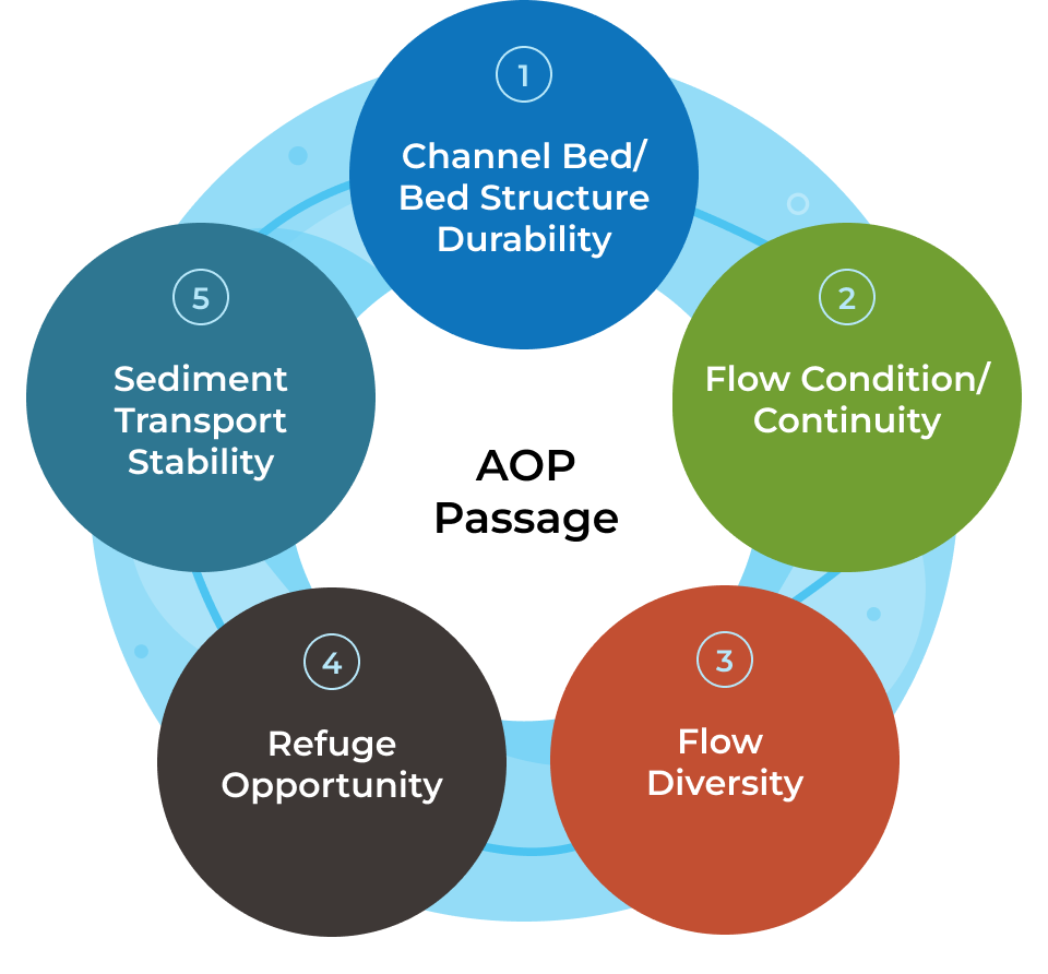
aopMAP has been field tested by an interdisciplinary team of engineers, hydrologists, geomorphologists, and fish biologists to provide for flexible collection of features that capture the important details of all types of channels and all types of AOP water crossing structures. The aopMAP team worked with an external panel of subject matter experts from resource agencies, transportation agencies, and academia to define five key themes believe to drive success in AOP passage structures. The aopMAP Field Monitoring Tool is structured around these key themes with data collection fields targeted at each.
Click on the numbered tabs below to learn about the five key themes.

The aopMAP Field Monitoring process was developed as a 3 step process to allow for rapid collection of the desired monitoring data at any AOP water crossing:
The aopMAP Field Monitoring Tool includes functionality to collect numerous photos for each feature of interest and GPS location tagging for the site and certain channel features. The photo and GPS tools provide valuable context for future comparative survey efforts by providing visual and location based data for context from prior surveys.
Additional details on the data collection fields, functionality and procedures are found in the aopMAP training videos and the aopMAP Field Manual.
aopMAP includes an As-Built Database Tool for use in recording important details on AOP water crossings. The As-Built Database Tool is a companion to the Field Monitoring Tool that allows for cross-referencing of the constructed and / or designed features of any AOP water crossing, all self-contained within the aopMAP databases. The As-Built Database Tool is useful to field inspection teams by proving accessible data on initial site conditions that can inform judgement on how systems are evolving. The tool also provides valuable data for future research by cataloguing initial AOP conditions for use in comparative analyses.
Posted June 18, 2024
$196M+ in FY2023 Grants available
Applications Due on September 23, 2024